VANCOUVER — The B.C. government says it's "extremely unsafe" to be near the banks of the Chilcotin and Fraser rivers both upstream and downstream from a massive landslide after water started flowing through the slide early Monday.
Emergency Management Minister Bowinn Ma said Monday that the water breaching the dam caused by the slide will cause river bank instability, although the chances of a worst-case scenario are "decreasing."
Ma says people should stay away and off the waters as officials monitor the flow downstream of the slide, which may impact the Farewell Canyon Bridge, about 22 kilometres downstream.
Evacuation alerts and orders along the rivers are not just about residential properties, she said.
"It is also about people recreating on the water or along the waterways," Ma said at a briefing Monday. "We need people to leave those areas, to not put their boats down, to not go down to take a look at the water, to not engage in recreation activities anywhere along the Chilcotin River or the Fraser River right now."
Officials said about 15 properties in the Cariboo and Thomson River Regional Districts are on evacuation order or alert.
Connie Chapman with the province's water management branch said the "pulse" of water from the dam breach will likely erode river banks, and carry debris from the slide.
She said the water started flowing through the debris slide, cutting about a 15 metre channel through the dam, and then began widening with water flows increasing by the hour.
She said some places along the rivers will see higher than spring runoff levels and cause the rivers to swell downstream in the coming days.
Chapman said officials will be monitoring debris in the "big pulse of water" now flowing downstream from the site of the slide.
An emergency alert issued by the province Monday said anyone along the banks of the rivers from Hanceville to the Fraser River, down to the Gang Ranch Road Bridge south of Williams Lake, must leave. Flooding and moving debris pose "a threat to human life," the alert said.
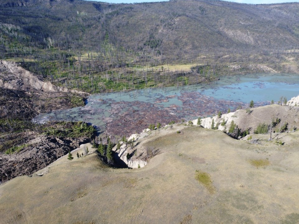
Images posted online by the province, and aerial footage over the slide site shared by Nathan Cullen, B.C.'s water and resource minister, show water getting through the massive slide.
The provincial government estimates the landslide that dammed the river is 1,000 metres long, 600 metres wide and 30 metres deep.
The Thompson-Nicola Regional District said all private properties within 300 metres of the banks of the Fraser River are on evacuation alert, including four addressed properties adjacent to the river, including two properties on Big Bar Road, one on Empire Valley-Big Bar Road, and another on Watson Bar Road.
The Tsilhqot'in National Government said in a social media post that people should also avoid river banks that were submerged by the lake that formed behind the slide. Tsilhqot'in Chief Joe Alphonse said the water backed up enough to start carving a path through the slide debris, and impacts on upcoming salmon runs remain his nation's biggest concern.
B.C. officials issued an evacuation order Sunday night for an area just north of where the Chilcotin River meets the Fraser River because of the danger of flooding caused by the landslide. In a news release late Sunday, officials with the Cariboo Regional District told residents to leave "immediately" and said people who chose to stay did so at their own risk. The evacuation order covered 3.5 square kilometres.
The massive landslide last week at Farwell Canyon located about 22 kilometres south of Williams Lake dammed the Chilcotin River and created a lake about 11 kilometres long behind the slide.
The Tsilhqot'in First Nation said that as of Sunday morning the slide was holding back 61 million cubic metres of water, equalling "24,400 Olympic swimming pools."
This report by The Canadian Press was first published Aug. 5, 2024.
The Canadian Press


